Regional Solar Power Forecasting with Deep Learning
Spatiotemporal forecasting of regional photovoltaic production from Meteosat image sequences using a ConvLSTM model trained and evaluated against measured production and a persistence baseline.
PhD Research
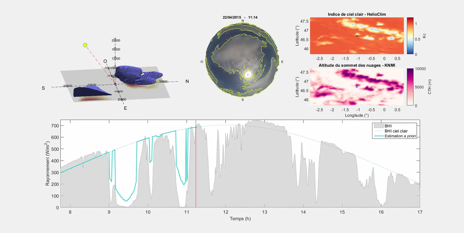
Fusion of ground-based sky-camera and geostationary satellite imagery to reconstruct cloud geometry and forecast solar irradiance and cloud shadows from 10 minutes to several hours ahead.


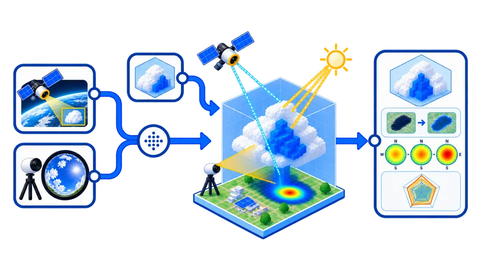
Satellite data (e.g., HelioClim) provide wide-area cloud coverage every 15 minutes, while hemispheric sky cameras capture local cloud motion every minute. By synchronizing both datasets, clouds can be observed simultaneously from above and below, reducing uncertainty due to limited spatial or temporal resolution.
Both data sources are aligned within a shared 3D coordinate system and a synchronized minute-by-minute timeline, ensuring consistent cloud tracking across space and time.

Clouds detected in both viewpoints are projected into 3D space. Their intersection defines the most probable cloud locations and heights. This enables accurate reconstruction of cloud geometry and their shadow paths on the ground.
Using these reconstructed clouds, the simulator estimates how much sunlight reaches the ground at each location, linking geometry directly to solar irradiance.
The system tracks cloud displacement between consecutive images using Cloud Motion Vectors (CMV) from both ground and satellite views. These motion fields are then propagated forward to predict cloud positions and irradiance for the next 10โ15 minutes.
Combined data are used to forecast short-term solar irradiance variations - including fast drops or increases due to moving clouds - critical for PV power forecasts and grid stability.
The synergy approach demonstrates higher spatial and temporal precision compared to using satellite or ground data alone. It offers a scalable and operational method for short-term solar forecasting, paving the way for more reliable renewable energy management.

Spatiotemporal forecasting of regional photovoltaic production from Meteosat image sequences using a ConvLSTM model trained and evaluated against measured production and a persistence baseline.

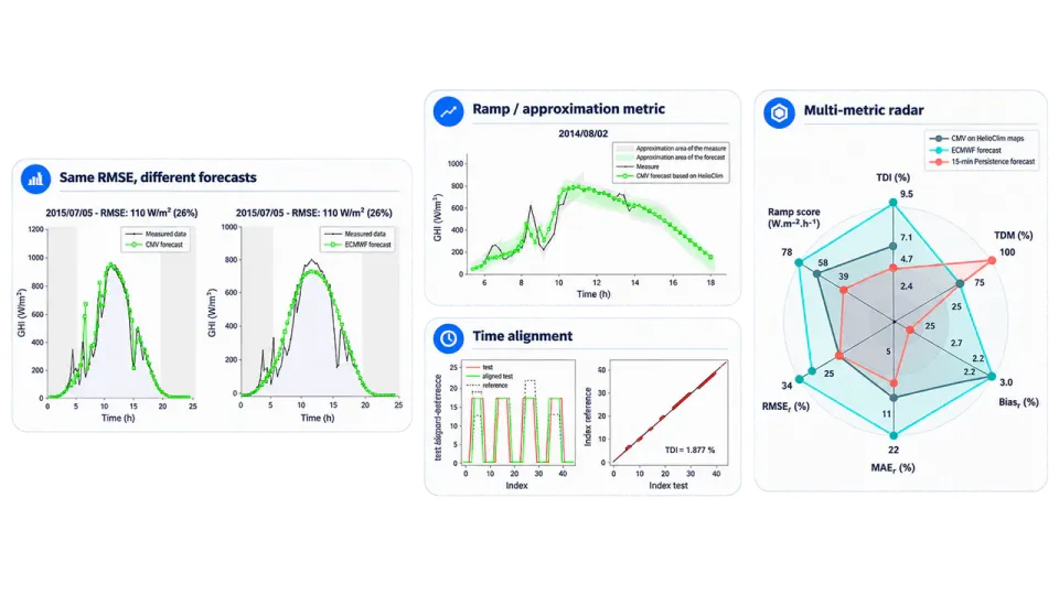
Scientific framework for evaluating solar forecasts beyond average error metrics, using Temporal Distortion Mix and a ramp metric to assess timing errors and rapid irradiance variations.

Controlled simulator of 3D cloud scenes, generating synthetic satellite and ground-camera views to validate voxel-based reconstruction, cloud localization, and shadow prediction for solar forecasting.